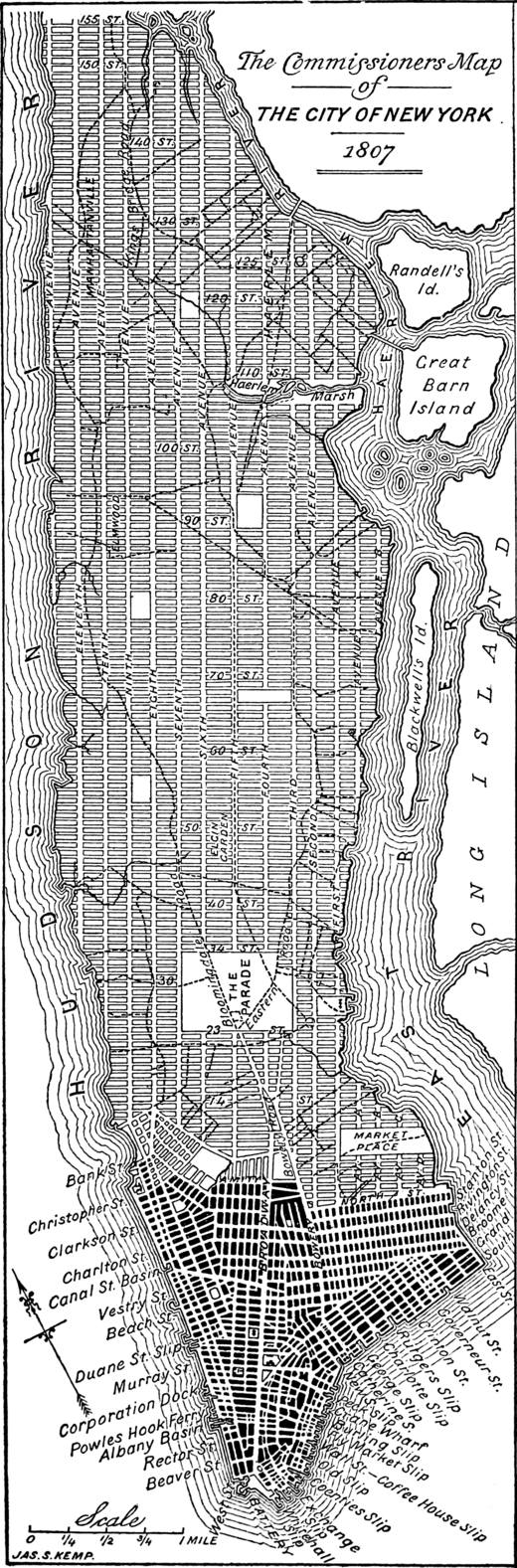
I’m reading about the general plan of Manhattan. The history of it is quite fascinating. When Europeans first settled in Manhattan, they built houses haphazardly. Back then, it was the Dutch who called the place “New Amsterdam.” After gaining independence, the USA saw a massive influx of migrants, and there was a pressing need to expand the city rapidly. Ultimately, in 1806, the authorities formed a commission of three people (Morris, Rutherfurd, De Witt) and gave them four years to devise a city plan. It was decided beforehand that any plan they came up with would be final. This commission did literally nothing for three out of the four years. Then, they started to make a move, meeting a few months before the deadline for key decisions. And they came up with a grid (see picture). In English, this is called a gridiron. They nowhere explained why they specifically chose a grid design. Probably because the deadline was just a few months away.
It’s interesting how the plan was then implemented. To transpose the grid onto the ground, nearly 1600 markers were installed — primarily square marble “monuments” with street numbers, located at every intersection. Where rocks prevented the use of marble markers, the rocks were blasted away, iron bolts were inserted, and encased in molten lead. In total, they set up 1549 marble markers and 98 iron bolts to delineate the grid pattern. Landowners who disagreed with the city cutting through their fields would dig everything up.
The famous Central Park, as it turned out, came about 70 years later, in 1876. On the map, you see The Parade—located further to the south—but the idea was originally to not build on this site, using it as an open space designated for military drills and as a rally point in case the city was invaded. At that time, they thought this Grand Parade could become the city’s “central park,” but over time the area gradually reduced, until what now remains is the current Madison Square Park. Just like that, it shrank from 97 hectares to 2.8 hectares. Optimized. At least Central Park eventually came into existence (341 hectares).
Broadway merged several streets that historically went against the grid (Bloomingdale and others).